Tesla brought its 3D Supercharger Site Maps to Canada on 13 May 2026, two weeks after the company finalised the feature for the US fleet and roughly three months after the first European pockets came online. The expansion is part of a global mapping push run out of Giga New York, where a dedicated team is now processing more than 300 Supercharger locations per week.
What 3D Site Maps Show
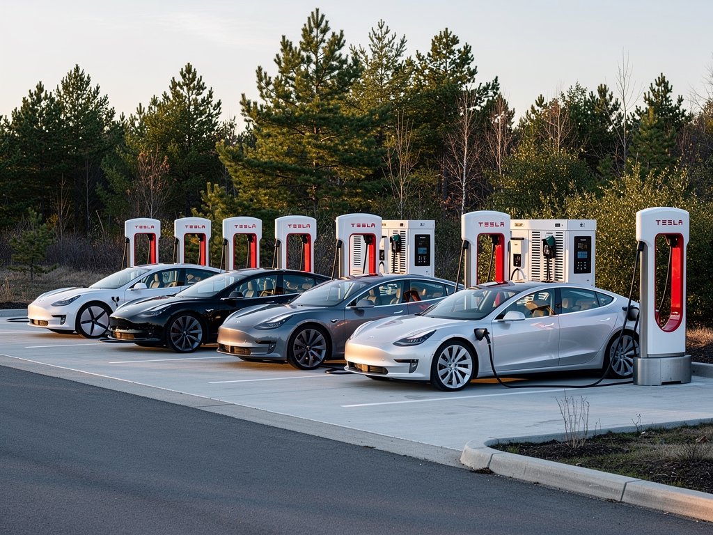
The 3D view replaces the basic pin-on-a-map approach that has been part of the in-car Supercharger flow since 2017. Instead of guessing the stall layout on arrival, drivers see a top-down rendering of the entire site with the exact position of every stall, the most efficient entry and exit path, and the live availability status of each charger.
- Real-time stall availability — green for free, red for occupied
- 3D vehicle models of the Teslas currently parked at each stall
- Highlighted trailer-friendly bays for Cybertruck and Model Y towing
- Marked accessible spots with widened approach lanes
- Suggested entry path based on the driver's approach direction
The view is rendered directly on the centre screen and updates as the car approaches. Tesla has not given an official firmware version requirement, but the feature has been live on 2026.14.x builds in early markets.
The Mapping Operation Behind It
The interesting part is the speed of the rollout. Tesla's dedicated team at Giga New York — separate from the engineering teams in Palo Alto and Austin — is mapping 300+ Supercharger sites every week, using a mix of high-resolution drone imagery, on-site survey vehicles and computer-vision reconstruction. At that pace the worldwide network of roughly 7,500 sites is on track to be fully 3D-mapped by the end of 2026.
| Market | 3D Site Maps status (May 2026) |
|---|---|
| United States | Live, all sites mapped |
| Canada | Just rolled out (13 May 2026) |
| Europe | Gradual expansion, urban sites first |
| Asia-Pacific | Partial — China and Japan in progress |
| Global coverage target | End of 2026 |
Why It Matters in Europe
For European drivers the 3D Site Maps are already live at a growing set of urban sites — Tesla started with high-traffic stations like Paris-La Défense, Berlin-Schönefeld and London-Heathrow before expanding into motorway corridors. The Canada milestone is a signal that the per-region rollout is accelerating rather than slowing down, which puts the full European motorway network within reach this year.
The feature matters most at unfamiliar V4 sites with high stall counts. V4 Superchargers can have 20 to 40 stalls in a single lot, often spread across two or three lanes, and getting to a free stall efficiently saves real time at peak hours. The trailer-bay highlighting is also significant for Model Y owners towing through France, Germany and the Alps, where a non-trailer stall can mean awkward repositioning with a hitched caravan.
What It Doesn't Do — Yet
The maps do not currently integrate with the Virtual Queue pilot Tesla launched at five US sites earlier in May. If those features merge later in the year, drivers approaching a busy site would see both the queue depth and the per-stall availability on the same screen, which would close a long-standing gap in the Supercharger experience. Tesla has not committed to that integration publicly, but the architecture clearly points in that direction.